Amanda Hodgson is a marine mammal scientist based in Perth, Australia and she recently shared some important work in the conservation of dugongs, turtles, whales and other marine animals.
Affectionately known as “sea cows”, Dugongs can be found in coastal waters around the world from East Africa to Australia. Unfortunately, their coastal habitat is impacted by development and fishing activities, leading to dwindling populations over the years.
Hodgson’s research is around monitoring marine megafauna and their critical habits. Most of that research has focused on dugongs. Dugongs are a really good indicator of ecosystem health, meaning if a seagrass meadow has a thriving dugong population, it’s likely doing quite well. If there aren’t many dugongs, then it can indicate an issue with the seagrass ecosystem.
Monitoring this can be quite difficult often done by spending many hundreds of hours staring out of the window of a small plane spotting and counting animals. In 2007, Hodgson was one of the first in the world to investigate the potential for using drones for fauna surveys.
While the drones were safer and provided better data, it still left a large workload relating to manually reviewing thousands of still images from each survey.
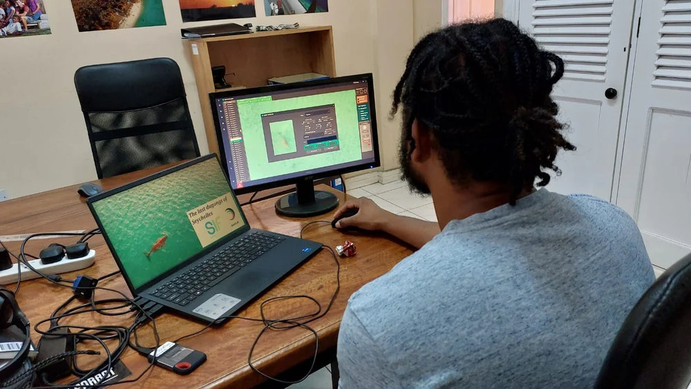
During the long hours of processing those drone images, Hodson reflects on the dream of a solution that could automate all the image processing. This is not an easy challenge with the solution needing to map the images, find the animals in the images and ensure accuracy.
Luckily in recent years, we have seen the expansion and accessibility of AI, making this a practical reality, rather than a dream.
By working with AI and geoprocessing experts, software that could help was created, a solution called WISDAM.
By using Google’s open-source TensorFlow technology, researchers were able to automate image processing and save a tremendous amount of human effort. WISDAM enabled automatic image analysis to find any images where animals that match with a model of the important sea creatures, as well as map and assess the background environment within the images.
WISDAM has allowed people who aren’t aerial survey experts by trade to conduct wildlife surveys.
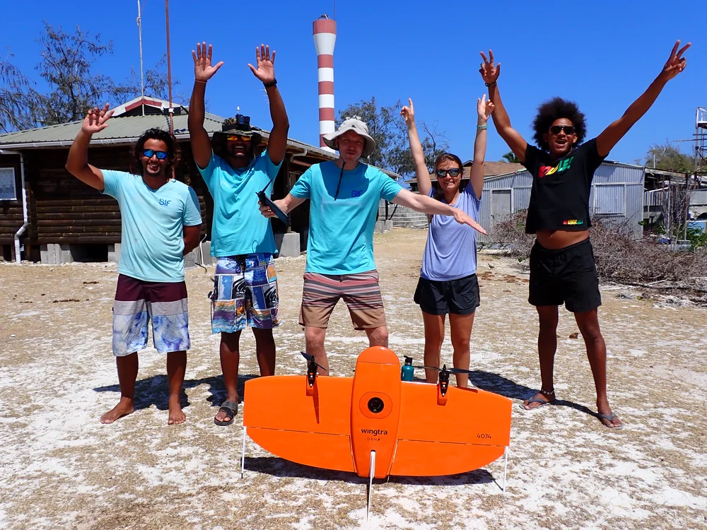
There’s always been a great need to develop research tools that are accessible and affordable in developing countries that form a large proportion of the dugongs’ range. Researchers, community groups and NGOs around the world are now using WISDAM to monitor dugongs in their local areas — from the Great Barrier Reef to the Seychelles to Saudi Arabia.
In certain places like the Seychelles (a collection of 115 islands in the Indian Ocean, off East Africa), where it is virtually impossible to conduct surveys with piloted planes. Now, for the first time, they’re using drones and WISDAM to locate and count their dugong population.
Since WISDAM was first developed, its capabilities have been expanded beyond dugongs and can now support surveys of turtles, whales and other marine animals. Hodgson says the hope is to keep developing this technology, and eventually expand it to different habitats and parts of the world — so one day, anybody will be able to help monitor wildlife and conservation efforts.